
Kisatchie National Forest Map +
3-Day Wild Azalea Trail Itinerary
3-day backpacking itinerary on the 24-mile Wild Azalea Trail, Louisiana's longest continuous footpath, from the Valentine Lake trailhead south to Woodworth through longleaf pine savanna, hardwood bottoms, and cypress creeks in the heart of Kisatchie National Forest.
Free interactive planner · drag & reorder your days, add stops, map it in minutes
Build your own Kisatchie trip, drag, reorder & map it.
Drag stops between days, adjust your dispersed camps, and add your own trailheads or a shuttle point with the place search. The live map and trail legs recalculate as you go, so you can tune the Wild Azalea Trail to your pace before you head into the forest.
Opens a side panel · reorder days, add custom stops, see your route live
Louisiana's longest footpath, end to end in a weekend, from Valentine Lake.
For a 3-day backpacking trip in Kisatchie National Forest, base your logistics out of Alexandria, Louisiana and thru-hike the Wild Azalea Trail, the state's longest continuous footpath at about 24 miles. The point-to-point route runs from the Valentine Lake Recreation Area trailhead south to Woodworth, so you will want a car shuttle or a second vehicle staged at the far end.
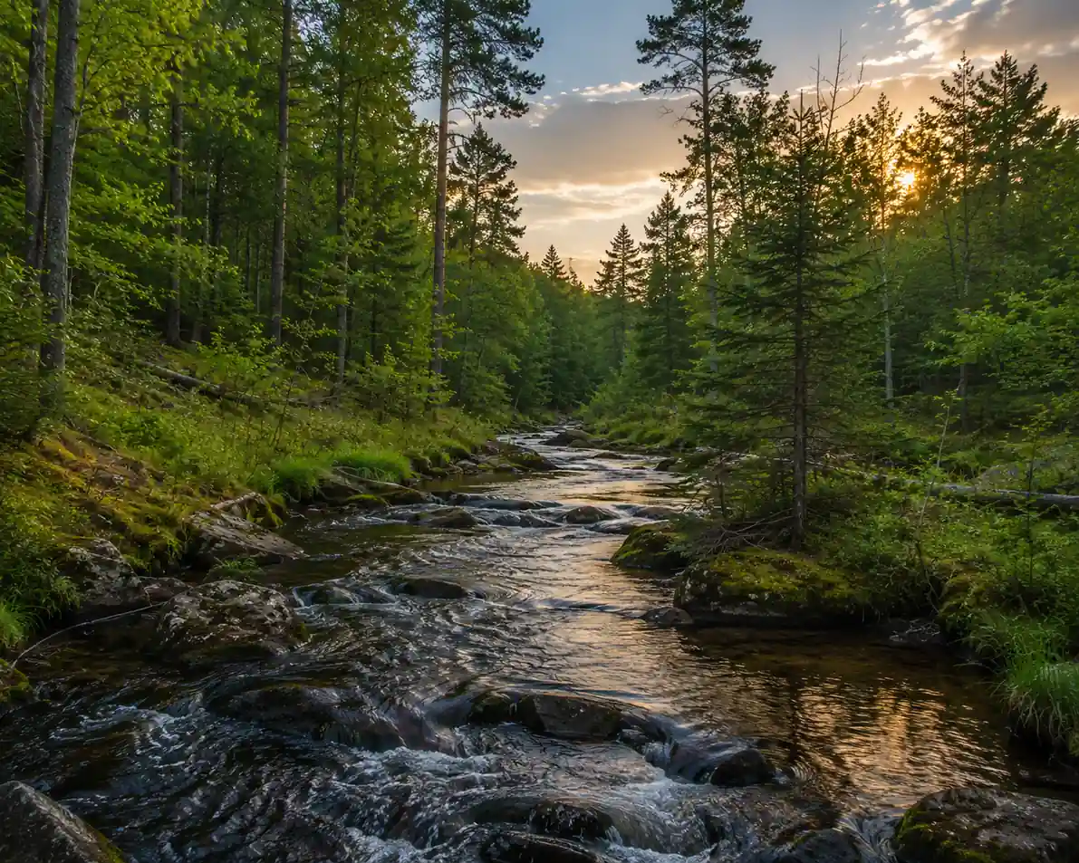
The trail crosses a full cross-section of central Louisiana: open longleaf pine savanna, hardwood bottoms, small streams, and cypress-lined creeks. Elevation gain is gentle, so the challenge is mileage, mud after rain, and self-sufficiency in water rather than climbing.
No permits or fees are required for backpacking or dispersed camping along the Wild Azalea Trail. October through April is the season to go, with cool, mild days and far fewer insects; late March and April bring the blooming wild azaleas the trail is named for. Avoid May through September, when heat, humidity, mosquitoes, and ticks are brutal.
No permits or fees are required for the trail or dispersed camping, so nothing needs reserving on the trail itself. The one thing to arrange in advance is your shuttle: this is a point-to-point route, so stage a second car at the Woodworth (southern) terminus or line up a shuttle driver before you start. Lodging the night before and after is easiest in Alexandria, about 12–15 miles from the trailheads.
Valentine Lake to First Camp · 8.5 miles
Drive from Alexandria to the Valentine Lake Recreation Area, the northern terminus of the Wild Azalea Trail, and park at the day-use area. Head south on well-marked white blazes through gentle longleaf pine forest, a relatively flat introduction to the Kisatchie backcountry.
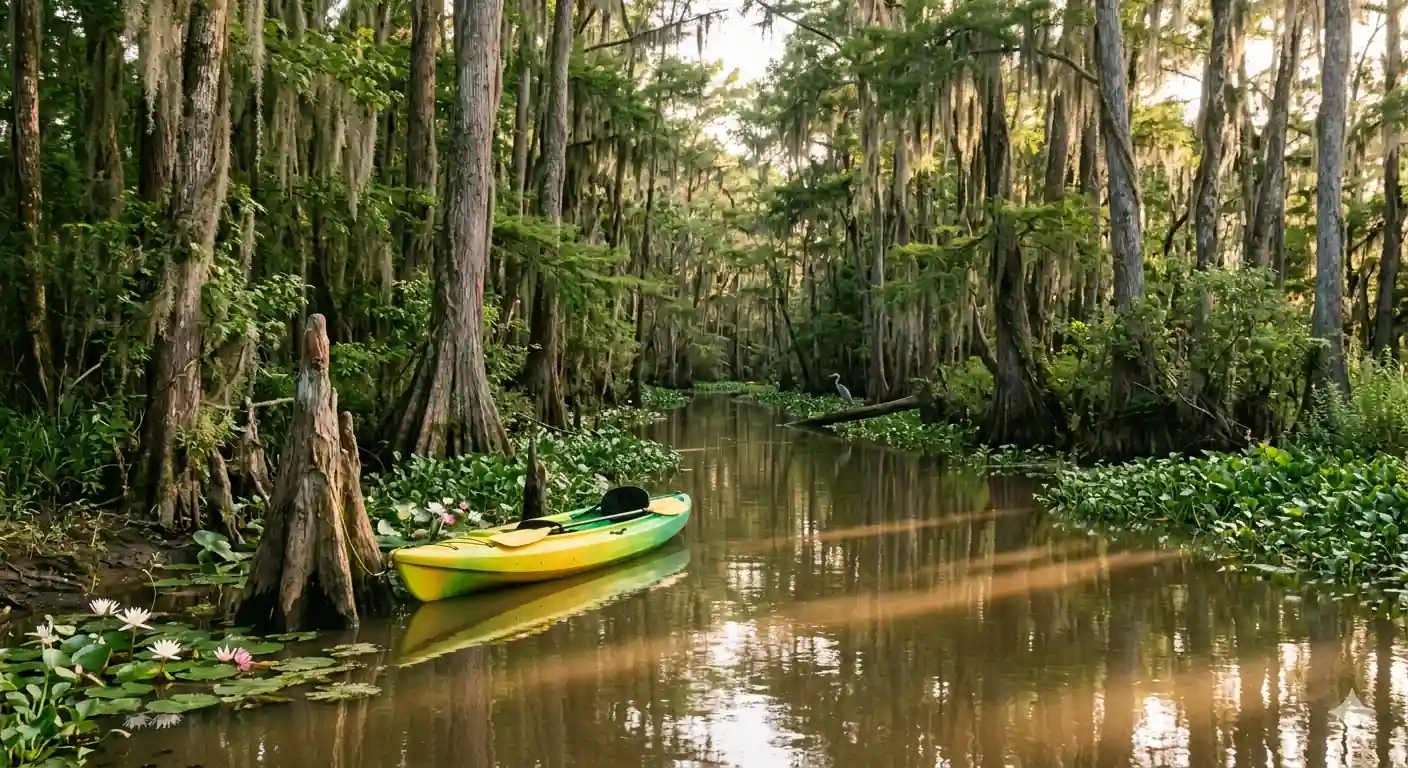
Continue south across small streams and quiet forest, covering roughly 8.5 miles. Set up a dispersed campsite off-trail near the Castor Creek / Kincaid vicinity, at least 100 feet from water and the trail, and pack out everything you bring in. Carry all the water you need, because natural sources are limited and must be filtered or treated.
- ~12 mi west of Alexandria · northern terminus · day-use parking
- ~8.5 mi · 4–5 hrs · white blazes · minimal elevation
- Dispersed camp near Castor Creek / KincaidNo permit · 100 ft from water & trail · Leave No Trace
- Stage a shuttle car at the Woodworth terminus before you start; the Wild Azalea Trail is point-to-point, not a loop.
- Follow the white blazes carefully. Fallen trees and overgrown sections can obscure the path, so carry a map (USFS or Avenza) and offline GPS.
- Camp only at dispersed sites at least 100 feet from water and the trail, and check for fire restrictions before lighting any campfire.
Longleaf pineFirst campThrough Kisatchie's Wild Heart · 9 miles
White blazesSecond campBreak camp and continue southbound. Today's 9 miles pass through the trail's most varied terrain, with stretches of cypress and tupelo near the creeks, especially if recent rains have soaked the bottoms. Watch for white-tailed deer, wild hogs, and the woodpeckers and songbirds the forest is known for.
The path stays generally flat but can turn muddy, so pick your line carefully through wet sections. Aim to reach a dispersed site near the Calcasieu / Evangeline Unit area for your second night. Filter or treat any water you collect, and be ready for biting insects near standing water even in the cooler months.
- ~9 mi · 4.5–6 hrs · cypress bottoms · can be muddy
- Watch for wildlife along the creeksDeer, songbirds & woodpeckers · give snakes & hogs room
- Dispersed camp near the Evangeline UnitFlat, well-drained site · filter or treat all water
- After rain the cypress-bottom sections get muddy; waterproof boots and gaiters keep the day comfortable.
- Water sources are limited and seasonal. Do not rely on natural water alone; carry enough per day or cache water if you have a support vehicle.
- Insect repellent is essential year-round here. Treat clothing with permethrin and check for ticks, including lone star ticks, every evening.
Finish to Woodworth · 6.5 miles
Pack up for the final leg. The last 6.5 miles roll back through characteristic longleaf pine, past occasional clearings and small ponds, to the southern terminus near Woodworth off Castor Plunge Road. Make sure you have enough water for the closing push, since resupply is nonexistent on trail.
Reach the southern trailhead, where your pre-staged shuttle or second vehicle should be waiting, and drive the short distance back to Alexandria. From here you can plan a Kisatchie Hills day hike, like the Longleaf Vista Interpretive Trail or the Backbone Trail, on your way out.
- ~6.5 mi · 3.5–4.5 hrs · final longleaf-pine stretch
- Castor Plunge Rd / FS 287 · pre-staged shuttle waiting
- Add a Kisatchie Hills Wilderness hike on the way out
- The southern terminus sits near Woodworth off Castor Plunge Road (FS 287); confirm your shuttle driver knows the exact meeting spot before you lose cell service.
- Cell service is spotty forest-wide, so do not depend on your phone; carry a physical map, compass, and ideally a satellite messenger or PLB.
- With time to spare, the paved 1.5-mile Longleaf Vista Interpretive Trail in the Kisatchie Hills is the forest's most scenic short hike and a great cool-down.
Final pinesKisatchieNow build your Kisatchie trip.
You've seen all three days. Open the free drag-and-drop planner and tune it for your dates, your pace, and whether you add a Kisatchie Hills day hike around your Alexandria base.
Essential backcountry logistics & planning.
Arrange a car shuttle
The Wild Azalea Trail is a point-to-point thru-hike from Valentine Lake to Woodworth, not a loop. Stage a second vehicle at the southern terminus or line up a shuttle driver before you start, otherwise you will have a long road walk back to your car.
No permits or fees
No permits or fees are required for backpacking or dispersed camping along the Wild Azalea Trail. This can change, so always check the official Kisatchie National Forest website before your trip for current regulations and any fire bans.
Dispersed camping rules
Dispersed camping is allowed throughout Kisatchie unless posted otherwise. Camp at least 100 feet from water sources and the trail, pack out all trash and food scraps, and follow Leave No Trace. Campfires are usually permitted unless restrictions are in place.
Carry & treat your water
Water sources are limited and seasonal, so do not rely on natural water alone. Carry enough for each day (3–4 liters capacity) or cache water if you have a support vehicle. Filter or treat everything you collect from creeks and ponds.
Go October through April
The ideal season is October through April, with cool, mild days and far fewer bugs. Winter nights get cold but days stay mild; March and April bring blooming azaleas plus rising humidity. Avoid May through September, when heat, humidity, mosquitoes, and ticks are extreme.
Getting there needs a car
Alexandria is the base town, about 12–15 miles from the trailheads, with Alexandria International Airport (AEX) roughly 30–45 minutes away. No public transportation reaches the trail, so a car (ideally two, for the shuttle) is required.
Everything you'll actually want to know.
Ready to go? Get your
Kisatchie National Forest route.
Trailheads and mileages, the shuttle logistics, dispersed-camping and water rules, drive times from Alexandria, and the best season to thru-hike the Wild Azalea Trail without the heat and bugs.
Instant book · Free cancellation · Secure payment via Stripe

Planning this trip?
Save it, share it with your crew, or find travelers heading the same way.

Liked this itinerary?
What other travelers are saying
Be the first to leave a tip or question for the next traveler.