Florida Trail Big Cypress Map +
5-Day Backpacking Itinerary
5-day Florida Trail backpacking itinerary through Big Cypress National Preserve. ~30 miles from the Oasis Visitor Center southern terminus north to the I-75 rest area, wading cypress strands and open wet prairie between the 7 Mile, 13 Mile, Oak Hill, and Ivy backcountry camps.
Free interactive planner · drag & reorder your days, add stops, map it in minutes
Build your own Big Cypress trip, drag, reorder & map it.
Drag stops between days, swap camps, and add your own trailheads with the place search. The live map and trail legs recalculate as you go, so you can tune this ~30-mile Big Cypress crossing to your pace before you wade into the swamp and lose the orange blazes underwater.
Opens a side panel · reorder days, add custom stops, see your route live
Wade the wildest swamp in America, Oasis to I-75.
The Florida Trail through Big Cypress National Preserve is unlike any other backpacking trip in the country. This ~30-mile section runs from the Oasis Visitor Center, the southern terminus of the Florida National Scenic Trail, north to the I-75 rest area at Mile Marker 63, crossing cypress strands, sawgrass prairie, and slippery marl mud, often with water from ankle- to knee-deep for miles at a stretch.
Over five days you camp at the only guaranteed dry ground on the route, the designated backcountry sites: 7 Mile Camp, 13 Mile Camp, Oak Hill Camp, and Ivy Camp, small elevated hammocks just above the swamp. Progress is slow, roughly 1 mile per hour through the open savannas, so plan short days and watch for the orange blazes that vanish under high water.
A free backcountry permit is required for every overnight group and can be arranged through the National Park Service; carry a copy the whole way. The dry season, roughly December through March, brings lower water, cooler temperatures, and fewer mosquitoes. Avoid the wet season, when high water, heat, and storms make the crossing genuinely dangerous.
Reserve your free Big Cypress backcountry permit well in advance for the December–March peak, and call the preserve at 239-695-2000 for current water levels before you commit. This is a point-to-point route, so arrange a shuttle or a two-car system between the Oasis Visitor Center and the I-75 MM63 rest area ahead of time. Naples is the nearest town for a hotel the night before and after.
Oasis Visitor Center to 7 Mile Camp · 7 miles
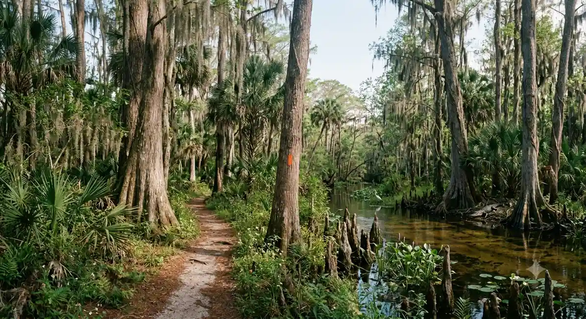
Park at the Oasis Visitor Center on US-41, the southern terminus of the Florida Trail. Confirm your backcountry permit with rangers, top off every water bottle, and head north on the orange blazes. The first miles start relatively dry before the trail drops into wet prairie and your first extended wading.
Your target is 7 Mile Camp (also called Woodpecker Camp), one of the designated dry hammocks in the preserve. Expect slow, deliberate going, watch each footfall in the tannin-stained water, and set up camp with daylight to spare so you can filter water and dry your feet.
- Free backcountry permit · fill all water bottles · restrooms
- ~7 mi · mixed dry & wet terrain · orange blazes
- Camp at 7 Mile Camp (Woodpecker Camp)Designated dry hammock · no facilities · filter water
- Get your free backcountry permit before you start and carry a copy the whole way, park staff need to know your group is out there.
- Wear closed-toe trail runners or water shoes that drain, never waterproof boots, they will fill with swamp water and never dry.
- Fill every bottle at Oasis. There is no reliable potable water on trail, so plan to filter tannin-stained swamp water at camp.
First wading7 Mile Camp7 Mile Camp to 13 Mile Camp · 6 miles
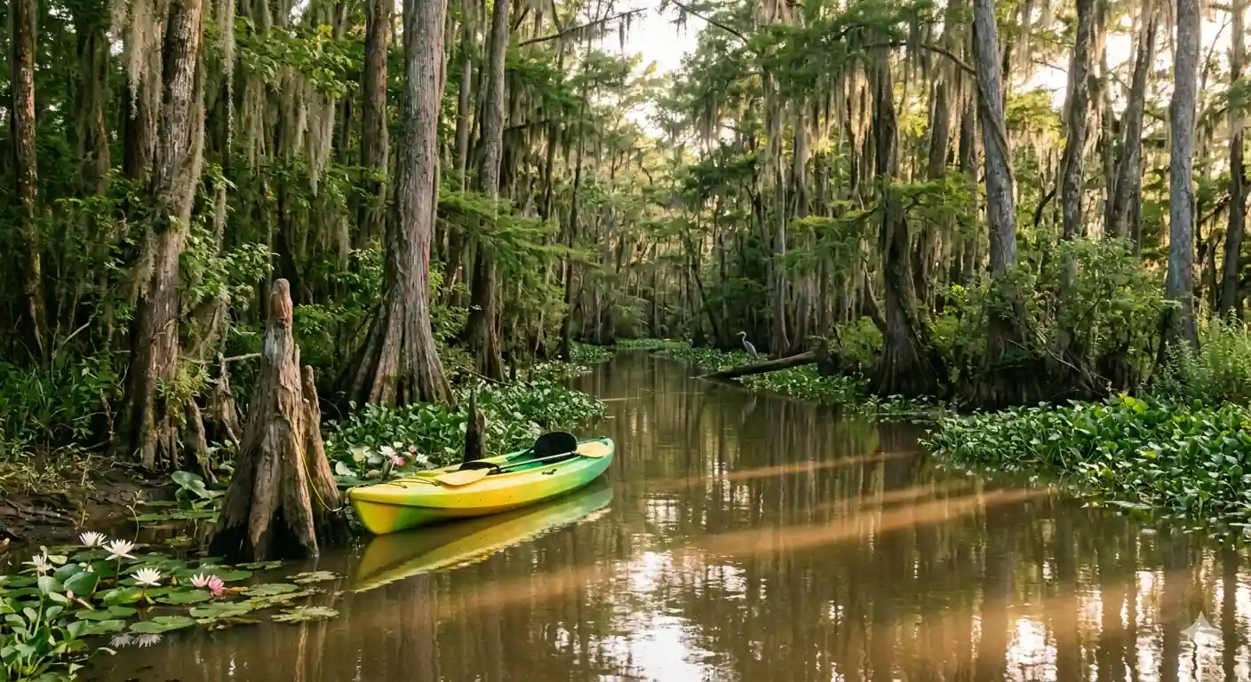
Wildlife13 Mile CampToday crosses the heart of the swamp, cypress domes and open wet prairie, passing 10 Mile Camp if you want a shorter day or a lunch stop. Water levels swing with recent rain, from ankle-deep to knee-deep, and the orange blazes can be hard to spot across the open prairie, so keep your GPS handy.
Push on to 13 Mile Camp, another small elevated hammock. Watch for alligators, wading birds, and deer along the way, and give every animal a wide berth. This is prime country for wildlife sightings, and the swamp comes alive with sound after dark.
- ~6 mi · consistent wading · GPS recommended
- 10 Mile Camp (optional break or stop)Designated dry site ~3 mi in · good lunch spot
- Camp at 13 Mile CampElevated hammock · no facilities · filter water
- Load a GPX track into Gaia GPS or AllTrails before you go. Orange blazes disappear underwater and across open prairie, and a compass belongs in your pocket as backup.
- Give alligators and snakes a wide berth and never feed wildlife. Most encounters are harmless if you keep your distance.
- If the day is going slow, 10 Mile Camp is a legitimate place to stop early, better to camp dry than to push into the dark.
13 Mile Camp to Oak Hill Camp · 7 miles
Leave 13 Mile Camp and continue north through alternating cypress strand and prairie. This stretch can hold some of the deeper water on the route, so take your time, test the bottom with trekking poles, and keep your pack rain cover and dry bags cinched.
Camp at Oak Hill Camp, around mile 20 and the last reliably drier ground before the long, exposed prairie miles ahead. Filter plenty of water here, dry your feet, and check thoroughly for ticks before you settle in for the night.
- ~7 mi · potentially deep water · slow going
- Camp at Oak Hill Camp~mile 20 · last drier ground before the north prairie
- Filter & treat swamp waterNo potable sources · carry 3–4 liters capacity
- Keep sleeping bag, spare clothes, and electronics in dry bags. A dunk is always one slick limestone hole away.
- Oak Hill is the last consistently drier campsite before the exposed prairie, so top off your water capacity here.
- Do a full tick check morning and night. Long sleeves and pants help with both ticks and sun on the open prairie.
Oak Hill CampNorth prairie aheadOak Hill Camp to Ivy Camp · 7 miles
Ivy CampSwamp at nightThe push from Oak Hill to Ivy Camp crosses the open savannas that Florida Trail hikers remember most, wide, exposed, and slow, where a mile can take an hour. There is little shade, so start early, ration sun protection, and keep filtering water whenever you can.
Ivy Camp is the final designated site before I-75 and your last night in the backcountry. Confirm your shuttle or second-car pickup time for the morning, store your food securely against black bears, and savor a last night of swamp sounds.
- ~7 mi · exposed prairie · ~1 mph · little shade
- Camp at Ivy CampLast designated site before I-75 · elevated hammock
- Store food against black bearsBear canister or a reliable bear-bag hang
- The north prairie is exposed and shadeless. Start early, wear a sun hat and long sleeves, and carry more water than feels necessary.
- Black bears live in Big Cypress. Store all food and scented items in a bear canister or a well-hung bear bag every night.
- Text or call your shuttle driver from Ivy if you have signal, and reconfirm the I-75 MM63 pickup time before you sleep.
Ivy Camp to I-75 (MM63) + Shuttle to Oasis · 3 miles
A short final morning brings you the last ~3 miles from Ivy Camp to the I-75 rest area at Mile Marker 63, the access point for the northern Florida Trail and the end of your Big Cypress crossing. You will hear the highway well before you see it.
Meet your pre-arranged shuttle or second vehicle at the rest area for the roughly 1.5-hour drive back to your car at the Oasis Visitor Center. Change into the dry clothes you stashed, and take a moment to appreciate what it means to have walked across the wildest swamp in America.
- ~3 mi · northern trail access · road noise
- Shuttle back to Oasis Visitor Center~1.5 hr drive · pre-arranged shuttle or second car
- Recover & refuel in NaplesNearest town for a hotel, hot shower & a real meal
- Stash a set of dry clothes and shoes in your shuttle vehicle. After five days wet, they are the best reward on trail.
- Cell service can be spotty at the MM63 rest area, so lock in your pickup time and a backup plan before you leave Ivy Camp.
- Naples is about 1.5 hours away and the easiest place for a hotel, a shower, and dinner the night you finish.
Final milesWildest swamp in AmericaNow build your Big Cypress trip.
You've seen all five days. Open the free drag-and-drop planner and tune it for your dates, your pace, and how much of the swamp you want to wade before your shuttle meets you at I-75.
Essential swamp-hiking rules & planning.
Free backcountry permit required
Every overnight group must obtain a free Big Cypress backcountry permit before hiking, and carry a copy the whole way so park staff know you are out there. Reserve well ahead for the December–March peak and call the preserve at 239-695-2000 for current water levels.
Footwear & wading gear
Wear closed-toe trail runners or water shoes that drain, never waterproof boots. Add gaiters against debris and scratches, and use trekking poles to test the bottom and keep your balance through slippery marl mud and limestone holes.
No potable water on trail
There are no reliable drinking-water sources between Oasis and I-75. Carry a quality filter or purifier and 3–4 liters of capacity, and treat all water from the swamp. It is tannin-stained tea-brown but safe once treated.
Navigation: GPS is essential
The Florida Trail is marked with orange blazes, but they vanish in deep water and across open prairie. Load a GPX track into Gaia GPS or AllTrails, carry a compass and a physical map as backup, and expect ~1 mph through the savannas.
Wildlife & food storage
Big Cypress is home to alligators, venomous snakes, and black bears. Give all wildlife a wide berth, never feed animals, and store food and scented items in a bear canister or a reliable bear-bag hang every night.
Go in the dry season & shuttle
Backpack December through March for lower water, cooler temperatures, and fewer mosquitoes; avoid the May–October wet season entirely. This is a point-to-point route, so arrange a shuttle or two-car system between Oasis and the I-75 MM63 rest area in advance.
Everything you'll actually want to know.
Ready to go? Get your
Big Cypress crossing dialed in.
Trailheads and mileages, the free backcountry permit, current water levels, the shuttle logistics between Oasis and I-75, dry-season timing, and the gear that keeps you moving through five days of swamp wading.
Instant book · Free cancellation · Secure payment via Stripe


Planning this trip?
Save it, share it with your crew, or find travelers heading the same way.

Liked this itinerary?
What other travelers are saying
Be the first to leave a tip or question for the next traveler.