Bob Marshall Wilderness Map +
6-Day Chinese Wall Backpacking Itinerary
6-day Bob Marshall Wilderness backpacking itinerary to the Chinese Wall, a 12-mile limestone escarpment along the Continental Divide, from the Benchmark Trailhead. Trail numbers, mileages, grizzly-country rules, and camp coordinates for one of the most remote treks in the Lower 48.
Free interactive planner · drag & reorder your days, add stops, map it in minutes
Build your own Bob Marshall trip, drag, reorder & map it.
Drag stops between days, adjust your daily mileage, and add your own camps and side trails with the place search. The live map and trail legs recalculate as you go, so you can tune the route to the Chinese Wall to your fitness before you head into grizzly country with no cell service.
Opens a side panel · reorder days, add custom stops, see your route live
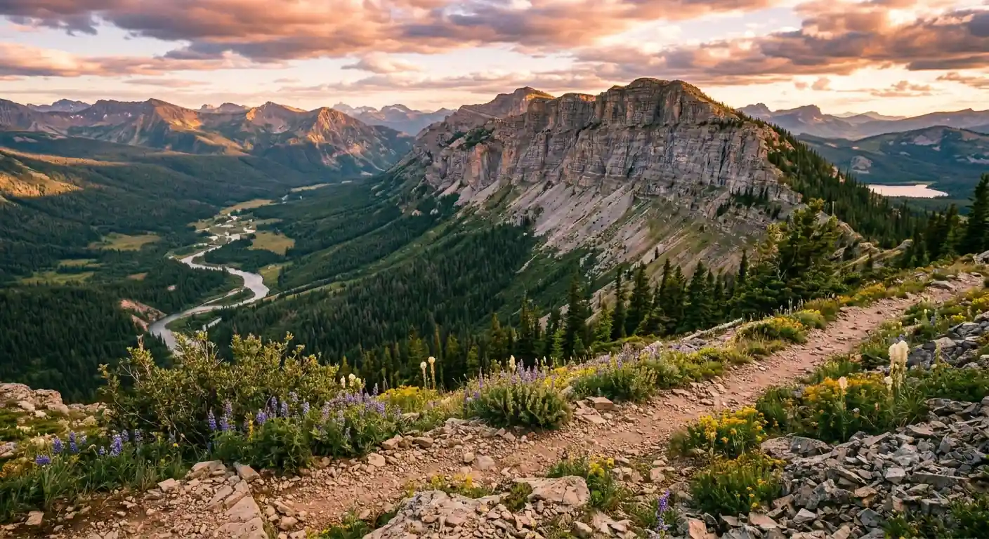
Six days to the Chinese Wall, from the Benchmark Trailhead.
For a 6-day backpacking trip in Montana's Bob Marshall Wilderness, base your logistics out of Augusta and the Benchmark Trailhead. This route follows Trail #201 up the South Fork valley, climbs to the iconic Chinese Wall, then descends the White River toward Big Salmon Lake, deep in one of the most remote landscapes in the Lower 48.
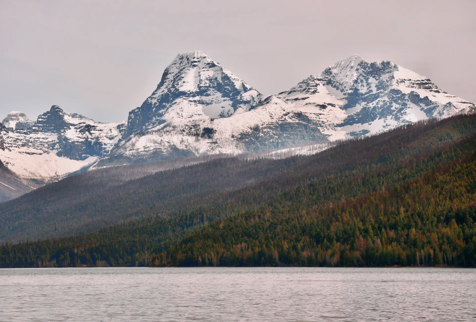
The centerpiece is the Chinese Wall, a 12-mile limestone escarpment 700 to 1,300 feet high that carries the Continental Divide Trail along its base. Days run long, with a couple of 10-plus-mile pushes and roughly 2,000 feet of climbing to reach the wall, so this trip is for fit, self-sufficient backpackers.
No permits or fees are required to backpack the Bob Marshall Wilderness, but this is prime grizzly country with virtually no cell service. Carry bear spray, store all food in a bear-resistant canister or a proper hang, and bring a satellite messenger. Mid-July to early September is the window; August offers the most stable weather.
No permit or reservation is needed to enter the Bob Marshall Wilderness, but the Benchmark area fills with horse packers in summer. The last services are in Augusta (gas and a general store); Great Falls, about 2 hours away, is the nearest city with full amenities and an international airport (GTF). Book a night in Augusta or Great Falls before and after your trek, and rent a bear-resistant canister early if you don't own one.
Benchmark Trailhead to South Fork Flathead · 10.5 miles
Drive in from Great Falls or Augusta to the Benchmark Trailhead, do a final gear check, and secure your vehicle. Begin hiking north on Trail #201, following the river through relatively flat terrain and crossing several small creeks. This is your gateway into the Bob Marshall Wilderness.
Aim for a primitive campsite along the South Fork Flathead River, about 10.5 miles in. There are numerous established sites; set up well away from the river, filter all water, and store food in a bear-resistant container. There is no cell service past Augusta, so make sure your satellite messenger is working before you go.
- ~80 mi / 2 hr from Great Falls · pit toilets · last few miles gravel
- Hike Trail #201 north up the valley10.5 mi · 5–6 hr · minimal elevation gain
- Camp along the South Fork Flathead RiverPrimitive dispersed sites · camp 200 ft from water
- Start hiking early to give yourself ample time for the 10.5-mile first day with a full pack.
- Carry enough water until you reach the river, and filter, purify, or boil everything you drink.
- Store all food, trash, and scented items in a bear-resistant container or hang them properly. This is prime grizzly habitat.
Benchmark TrailheadRiver campClimb to the Chinese Wall · 7.5 miles
Toward the wallWall base campBreak camp and continue north on Trail #201 before turning onto the Lick Creek Trail (#202), which begins a significant, steady climb toward the Chinese Wall. The landscape transitions from river bottom to open, higher-elevation terrain, and the views expand with every switchback, roughly 2,000 feet of gain over the day.
Camp near the base of the Chinese Wall, ideally in the saddle where the Continental Divide Trail intersects. These sites are exposed to wind and weather, so choose carefully and secure your gear. Water can be limited up here, so carry extra, and settle in for sunset light on 1,000 feet of limestone.
- Climb via Lick Creek Trail #202 · ~2,000 ft gain
- Ascend Lick Creek Trail (#202)5.5 mi · 4–5 hr · forest to open slopes
- Camp at the base of the Chinese WallExposed sites near the CDT saddle · carry extra water
- Refill and treat water before you leave the river, because sources thin out on the climb to the wall.
- The ascent up Lick Creek Trail is consistent and can be challenging with a full pack, so pace yourself.
- Camps at the base of the wall are exposed. Stake out well and secure loose gear against strong afternoon winds.
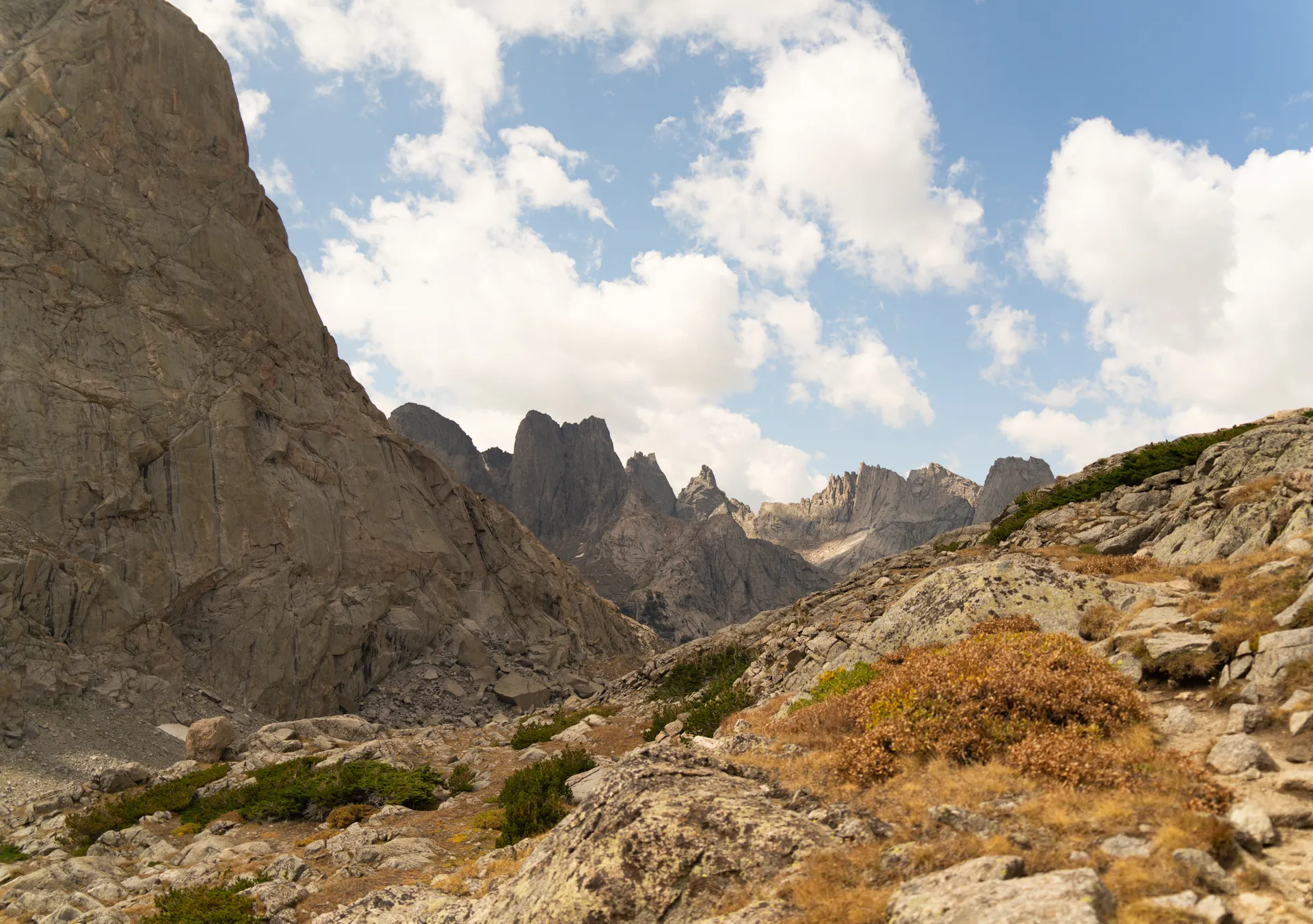
Explore the Chinese Wall & the CDT · 5–8 miles
Dedicate today to the Chinese Wall itself. From basecamp, take a light daypack and hike north or south along the Continental Divide Trail, which runs directly along the base of the wall for miles. Different vantage points reveal the full scale of the escarpment and the wilderness stretching to the horizon in every direction.
Watch the cliffs for mountain goats and bighorn sheep, and let the changing light work the limestone for photographs. Return to your established camp for a second night, which keeps the day light and leaves you rested for the descent. Be ready for strong winds and a real temperature drop after dark at this elevation.
- 5–8 mi round trip · 3–5 hr · light daypack
- Photograph the Chinese WallBest light morning and late afternoon · watch for goats
- Second night at the wall basecampRest, stargaze, and review maps for the descent
- Carry a daypack with water, snacks, and rain gear. Afternoon thunderstorms are common all summer.
- The CDT along the wall can be narrow and exposed in sections, so mind your footing.
- Replenish and treat water when you find a good source, and prepare for a sharp temperature drop overnight.
The wallBasecampDescend to the White River · 9 miles
Valley descentRiver campBreak camp and begin the descent, dropping down the Lick Creek Trail (#202) and rejoining the valley trail. The downhill goes faster than the climb but still demands careful footing with a full pack, so trekking poles earn their keep. The terrain gentles as you work your way toward the White River.
Camp along the White River, roughly 9 miles from the wall, near its confluence with the South Fork. The river offers good water and excellent catch-and-release fishing for cutthroat trout. Find an established site, store your food properly, and enjoy a well-earned rest by the water.
- Descend Lick Creek Trail (#202)~5.5 mi · 3–4 hr · roughly 2,000 ft of loss
- Continue toward the White River~3.5 mi · gentle grade · good water refills
- Camp near the White RiverRiverside sites · cutthroat trout · catch and release
- Use trekking poles on the descent to save your knees, and take the steep, dusty sections slowly.
- The White River confluence has reliable water and good fishing. Refill and treat before camp.
- Watch for horse packers on the valley trails and step to the downhill side to let stock pass.
Hike toward Big Salmon Lake · 12 miles
Today is the longest push, continuing down the valley toward Big Salmon Lake. The terrain is generally rolling to flat as you follow the river past smaller streams and potential campsites. Pace yourself, take regular breaks, and keep an eye out for larger wildlife in the open stretches.
Aim for a camp in the vicinity of the Big Salmon Lake area, a common staging point for horse packers with more established, if still primitive, sites. You are still inside the wilderness boundary, so all backcountry regulations apply. Enjoy your last full night under the vast Montana sky.
- Hike the valley toward Big Salmon Lake12 mi · 6–7 hr · rolling terrain
- Common horse-packer staging point · more established camps
- Final wilderness campStill inside the wilderness · all backcountry rules apply
- Carry adequate water for this longer stretch and treat it, as sources between camps can be spread out.
- This section is a good chance to spot larger wildlife, so make noise in dense vegetation.
- Even at the more-established Big Salmon Lake camps, follow every Leave No Trace and food-storage rule.
Valley milesLast campExit & celebrate in Augusta · 6 miles
Back at BenchmarkAugustaOn your final day, complete the last section of trail out of the wilderness, roughly 6 miles of mostly flat or downhill walking, and reflect on the journey through one of America's most pristine landscapes. Back at the trailhead, check for any gear left behind and pack out every scrap of trash.
Drive out and stop in Augusta, Montana, a small, authentic Montana town, for a well-earned meal and a chance to swap trip stories. It's also a resupply point for gas and basics before you continue to Great Falls or home.
- Hike the final trail section out~6 mi · 2.5–3 hr · mostly flat to downhill
- Post-hike meal in Augusta, MTSmall-town dining · resupply for gas and basics
- Do a final sweep of camp and the trailhead for gear, and pack out all trash and food scraps.
- Augusta has limited but hearty dining and is the last easy resupply before Great Falls.
- Great Falls (GTF) is about 2 hours from the trailhead if you're flying out the same day.
Now build your Bob Marshall trip.
You've seen all six days. Open the free drag-and-drop planner and tune it for your dates, your mileage, and whether you set up a shuttle or return the way you came.
Essential wilderness rules & planning.
This is grizzly country
The Bob Marshall Wilderness is prime grizzly habitat. Carry bear spray and know how to use it. All food, trash, and scented items must go in a bear-resistant container (Ursack, BearVault) or be hung at least 10 feet up and 4 feet out from the trunk. Make noise while hiking, especially in dense vegetation.
No permits, but be self-sufficient
No permits or entry fees are required for personal backpacking trips. Commercial outfitters need special use permits. This is a strenuous, remote route with long-mileage days and real elevation, so come experienced, fit, and comfortable with backcountry navigation.
Filter every drop of water
Water is generally plentiful along the South Fork Flathead River and its tributaries, but all of it must be filtered, purified, or boiled. Carry a reliable filter plus a backup method, and top off before long or high-elevation stretches where sources thin out.
Leave No Trace
Pack out everything you pack in. Bury human waste in a cathole 6–8 inches deep and at least 200 feet from water, trails, and camps. Wash and cook 200 feet from water, camp on durable surfaces, keep groups small, and use existing fire rings where fires are allowed.
Go mid-July to early September
Before mid-July, snow can block high passes and river crossings run dangerously high with snowmelt. By late September, new snow and hard cold return. August offers the most stable weather, though afternoon thunderstorms are common all summer.
Getting there needs a car
Great Falls International Airport (GTF) to the Benchmark Trailhead is about 80 miles and 2 hours. From Augusta, take Ranger Station Road then Forest Road 235 to Benchmark; the last few miles are gravel. There is no cell service past Augusta, so carry a satellite messenger like an InReach or Spot.
Everything you'll actually want to know.
Ready to go? Get your
Bob Marshall Wilderness route.
Trail numbers and mileages, the grizzly-country food-storage rules, water and camp logistics, drive time from Great Falls, and the mid-July-to-September window you need to reach the Chinese Wall safely.
Instant book · Free cancellation · Secure payment via Stripe

Planning this trip?
Save it, share it with your crew, or find travelers heading the same way.

Liked this itinerary?
What other travelers are saying
Be the first to leave a tip or question for the next traveler.