Black Hills Backpacking Map +
6-Day Centennial Trail Itinerary
6-day Black Hills backpacking itinerary along the most scenic 60-mile section of the Centennial Trail (#89), from French Creek Horse Camp through Custer State Park and the Black Hills National Forest to a summit of Black Elk Peak (7,242 ft), the highest point in South Dakota.
Free interactive planner · drag & reorder your days, add stops, map it in minutes
Build your own Black Hills trip, drag, reorder & map it.
Drag stops between days, swap camps, and add your own trailheads and side trips with the place search. The live map and trail legs recalculate as you go, so you can tune the Centennial Trail section to your mileage and pace before you head into the backcountry.
Opens a side panel · reorder days, add custom stops, see your route live
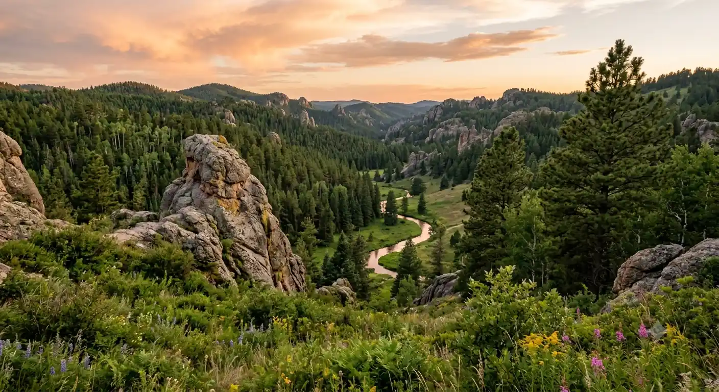
Sixty miles of the Centennial Trail, ending on the roof of South Dakota.
This 6-day Black Hills backpacking itinerary follows the most scenic 60-mile stretch of the Centennial Trail (#89), a point-to-point route through Custer State Park and the Black Hills National Forest. Base your logistics out of Custer, South Dakota, and use a shuttle so you can hike the section linearly without doubling back to your car.
The trail runs through rolling ponderosa pine forest, open meadows, and dramatic granite spires, gaining elevation steadily as it climbs toward Black Elk Peak (7,242 ft), the highest point in South Dakota and the highest summit east of the Rockies. The historic stone fire tower on top delivers 360-degree views over the entire Black Hills.
Backcountry camping permits are required for both Custer State Park and the Black Hills National Forest, and a Custer State Park entrance license is required for vehicles. The shoulder seasons, May–June and September–October, bring moderate temperatures, fewer bugs, and thinner crowds than the hot, stormy summer.
Custer State Park backcountry permits should be reserved in advance, often 3–6 months out for peak season, through the South Dakota Game, Fish and Parks website. A Custer State Park entrance license runs about $20 per vehicle for 7 days. Black Hills National Forest backcountry permits are typically self-issued at trailheads or available at Forest Service offices. Book your Custer lodging and trailhead shuttle early, both fill up in summer and fall.
Arrive in Custer & Shuttle Logistics
Fly into Rapid City Regional Airport (RAP) and drive about an hour southwest to Custer, South Dakota, your base town. Check into pre-booked lodging, organize gear, and pick up any last-minute resupply and fuel in town.
Arrange a local trailhead shuttle to drop you at the southern terminus of your section at French Creek Horse Camp inside Custer State Park. Shuttling one direction lets you hike the Centennial Trail linearly without backtracking for your vehicle. Confirm your Custer State Park entrance license and backcountry permit before you leave town.
- Drive from Rapid City Airport (RAP) to Custer~50 mi · about 1 hour · rental cars at RAP
- Check into Custer lodging & resupplyMotels and cabins in town · last-minute gear and fuel
- Arrange trailhead shuttle to French Creek Horse CampLocal outfitters · confirm drop-off and pick-up points
- Rapid City Regional Airport (RAP) is the closest major airport, about an hour from Custer, with rental cars on site.
- A trailhead shuttle lets you hike the Centennial Trail point-to-point without returning for your car. Confirm both drop-off and pick-up locations in advance.
- Buy a Custer State Park entrance license and reserve your backcountry permits before you leave town, as cell service is unreliable on the trail.
French Creek Horse CampCentennial Trail #89French Creek to Iron Creek · 11 miles
French Creek startCuster State ParkStart your backpacking section from French Creek Horse Camp on Trail #89. The trail immediately enters a landscape of rolling hills, open meadows, and shaded ponderosa pine, with moderate elevation changes and several small creek crossings.
Cover roughly 11 miles north to camp at Iron Creek Horse Camp, a designated backcountry area within Custer State Park. Make sure your Custer State Park backcountry permit is secured, and filter water from reliable sources since supply can be seasonal.
- Entrance license ~$20/vehicle · backcountry permit reserved ahead
- ~11 mi · ~1,200 ft gain · 5–7 hours · Trail #89
- Overnight at Iron Creek Horse CampDesignated backcountry site · Custer State Park · filter water
- Trail #89 is well-marked, and the initial miles from French Creek are generally gentle rolling terrain.
- Water sources can be limited, so carry enough to reach the next reliable creek and filter everything you collect.
- A Custer State Park backcountry permit is required to camp at Iron Creek Horse Camp. Pack out all waste and camp only in the designated area.
Iron Creek to Grizzly Bear Creek · 10 miles
Continue north on the Centennial Trail, pushing deeper into Custer State Park. Today's ~10 miles feature more prominent granite outcroppings, deeper forest, and a mix of ascents and descents as the trail winds through rugged terrain.
Set up a primitive camp near Grizzly Bear Creek. This is an undeveloped area, so choose a durable surface well away from water and follow Leave No Trace strictly. Water along this stretch may be seasonal, so carry a filter and plan your supply carefully.
- Centennial Trail through Custer State Park~10 mi · ~900 ft gain · 5–6 hours · granite formations
- Granite outcrops & wildlife along the trailDeer, wild turkeys, and Custer's famous rock formations
- Overnight near Grizzly Bear CreekPrimitive backcountry site · Custer State Park · filter water
- The trail can be rocky through this section, so trekking poles help on the ascents and descents.
- Grizzly Bear Creek is an undeveloped site with no facilities. Camp on a durable surface at least 200 feet from water and pack out everything.
- Water may be limited here, especially in late summer. Filter from reliable sources and carry enough for dry stretches.
Trail #89 northToward Black Elk PeakGrizzly Bear Creek to Badger Hole · 10 miles
Leaving Custer SPBlack Elk aheadToday's ~10 miles bring you closer to the heart of the Black Hills National Forest as the trail transitions out of Custer State Park. Expect an undulating path through dense ponderosa pine, some open areas, and good odds of spotting deer and wild turkeys.
Camp at Badger Hole, a backcountry area within the Black Hills National Forest. A separate Black Hills National Forest backcountry permit is required here, generally self-issued at trailheads, and you should check for fire restrictions before setting up camp.
- Centennial Trail into Black Hills National Forest~10 mi · ~700 ft gain · 5–6 hours · dense pine forest
- Separate from Custer State Park · often self-issued at trailheads
- Overnight at Badger HoleBackcountry site · Black Hills National Forest · check fire rules
- The Black Hills National Forest requires its own backcountry permit, separate from Custer State Park. Grab it before you enter forest land.
- Check for fire restrictions before your trip and each evening. Campfires may be banned in dry months, so plan to cook on a stove.
- Store food in a bear canister or hung bag away from camp. Black bears are uncommon but present, and food storage also deters smaller critters.
Badger Hole to Black Elk Peak Area · 12 miles
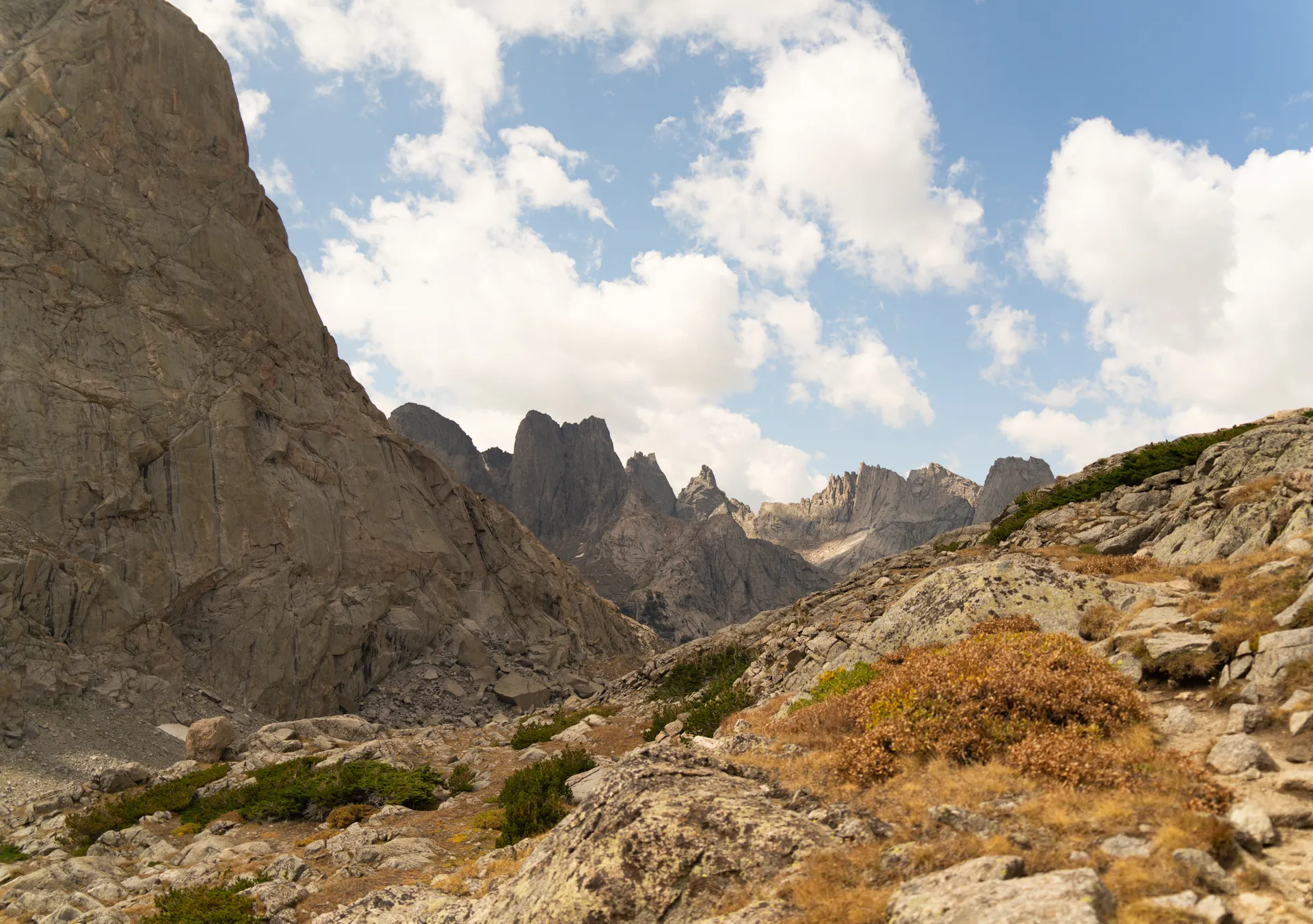
This is the biggest day, roughly 12 miles with the trip's largest sustained climbs as the Centennial Trail approaches the Black Elk Wilderness. The trail ascends steadily through increasingly rugged terrain and impressive rock formations, with views opening up as you gain elevation.
Establish camp at a designated backcountry site near the Black Elk Peak area, positioning yourself for an early-morning summit bid. Temperatures drop at higher elevation, so pack warm layers and secure your Black Hills National Forest permit for the night.
- Centennial Trail to the Black Elk Peak area~12 mi · ~1,500 ft gain · 6–8 hours · biggest climbs of the trip
- Views open up toward the high countryRugged terrain and rock formations near the Black Elk Wilderness
- Overnight near Black Elk PeakDesignated backcountry site · Black Hills NF · cool at elevation
- This is the longest and steepest day, so start early and pace the sustained climbs toward the Black Elk Wilderness.
- Camp positions you for an early summit push. Choose a site that minimizes impact and stays within Black Hills National Forest regulations.
- Nights are noticeably cooler at elevation. A 20–30°F sleeping bag and warm layers make the pre-dawn summit start more comfortable.
Steady climbHigh countryBlack Elk Peak Summit & Departure · 7 miles
Sylvan Lake finishBack to CusterStart early for the ascent of Black Elk Peak (7,242 ft), the highest point in South Dakota and a site sacred to the Lakota. The climb is steep but well-maintained, topping out at a historic stone fire tower with 360-degree views over the Black Hills. Formerly called Harney Peak, it was renamed in 2016 to honor the Oglala Lakota holy man Black Elk.
After the summit, descend via Trail #9 toward the Sylvan Lake area, a scenic granite-ringed hub in Custer State Park. Meet your pre-arranged shuttle here for transport back to Custer or Rapid City, and cap the trip with a celebratory meal in town before your departure.
- Highest point in SD · historic stone fire tower · 360° views
- Descend Trail #9 to Sylvan Lake~4 mi · ~1,000 ft descent · granite spires and lake views
- Shuttle pick-up & departureFrom Sylvan Lake · back to Custer or Rapid City (RAP)
- Start the summit push early for the best light and to beat afternoon thunderstorms, which build fast on the exposed high point.
- Black Elk Peak is sacred to the Lakota people. Treat the summit and fire tower with respect and pack out everything you carry up.
- Confirm your shuttle pick-up time and location at Sylvan Lake in advance, and allow ample time to reach Rapid City airport for your flight.
Now build your Black Hills trip.
You've seen all six days. Open the free drag-and-drop planner and tune it for your dates, your daily mileage, and whether you shuttle from Custer or Rapid City.
Essential permits, water & backcountry rules.
Two permit systems
Backcountry camping permits are required for both Custer State Park and the Black Hills National Forest. Reserve Custer State Park permits in advance, often 3–6 months out for peak season, through the South Dakota Game, Fish and Parks website. Black Hills National Forest permits are typically self-issued at trailheads or available at Forest Service offices.
Park entrance license & shuttle
A Custer State Park entrance license is required for all vehicles, about $20 per vehicle for 7 days, separate from camping permits. Because the route is point-to-point, arrange a trailhead shuttle from a local outfitter so you can hike linearly without returning for your car.
Plan your water carefully
Water sources along the Centennial Trail can be seasonal and unreliable, especially in late summer and dry spells. Carry a filter or purification tablets, treat all natural water, and be ready to carry enough for long stretches between reliable creeks.
Wildlife & food storage
The Black Hills are home to bison in Custer State Park, plus deer, mountain goats, wild turkeys, and occasionally black bears or mountain lions. Store food in a bear canister or hung bag away from camp and keep a safe distance from all wildlife, especially bison.
Fire restrictions & Leave No Trace
Check for fire restrictions before and during your trip, as campfires may be prohibited in dry months. Cook on a camp stove, pack out all trash, dig catholes 6–8 inches deep and 200 feet from water, and camp on durable surfaces at designated sites where available.
Go in the shoulder seasons
The best backpacking windows are May–June and September–October, with moderate temperatures, lower insect activity, and thinner crowds. Summers can be hot and stormy; winters bring snow and ice that make much of the trail inaccessible without specialized gear.
Everything you'll actually want to know.
Ready to go? Get your
Black Hills Centennial Trail route.
The permit systems for Custer State Park and the Black Hills National Forest, trailhead shuttle logistics, daily mileages and water strategy, and the summit timing you need to top out on Black Elk Peak, the highest point in South Dakota.
Instant book · Free cancellation · Secure payment via Stripe

Planning this trip?
Save it, share it with your crew, or find travelers heading the same way.

Liked this itinerary?
What other travelers are saying
Be the first to leave a tip or question for the next traveler.