Atchafalaya Basin Kayaking Map +
3-Day Henderson Weekend Itinerary
3-day Atchafalaya Basin kayaking itinerary from Henderson, Louisiana. Paddle the Big Cypress Loop, the marked Lake Fausse Pointe canoe trail, and a Butte La Rose basin route through the largest river swamp in the United States, with cypress-tupelo forest, Spanish moss, and alligators along the way.
Free interactive planner · drag & reorder your days, add stops, map it in minutes
Build your own Atchafalaya trip, drag, reorder & map it.
Drag stops between days, swap launches, and add your own bayous and put-ins with the place search. The live map and paddle legs recalculate as you go, so you can tune this Atchafalaya Basin loop to your pace before you lose cell service in the swamp.
Opens a side panel · reorder days, add custom stops, see your route live
The largest river swamp in the United States, by kayak.
For a 3-day kayaking weekend in Louisiana, base your logistics out of Henderson, the gateway town on the western edge of the Atchafalaya Basin. This itinerary strings together three flatwater paddles, roughly 16 miles total, through cypress-tupelo forest, black-water bayous, and open swamp lakes draped in Spanish moss.
Day one warms up on the Big Cypress Loop (3.6 miles) from McGee's Landing. Day two moves to the marked canoe trail at Lake Fausse Pointe State Park, a 6,000-acre isolated swamp of huge bald cypress. Day three paddles the main basin from the Butte La Rose landing before you head home through Breaux Bridge, the Crawfish Capital of the World.
No permits are required for recreational kayaking in public waters here, but the basin is a maze, so carry a GPS with pre-loaded maps and expect unreliable cell service. Alligators are present year-round: keep your distance and never feed wildlife. October through April brings cooler temperatures and far fewer insects than the hot, buggy summer.
Cabins and campsites at Lake Fausse Pointe State Park fill up fast on cooler-season weekends (October through April), so reserve 3 to 6 months out through lastateparks.com. Kayak rentals at the park run about $7 per hour or $35 per day; if you paddle the Big Cypress Loop, McGee's Landing in Henderson is the put-in and rents canoes on site. Confirm current water levels (USGS Butte La Rose gage) before you launch, since the basin fluctuates a lot with river management.
Arrive in Henderson & the Big Cypress Loop · 3.6 miles
Arrive in Henderson, the primary access point for the Atchafalaya Basin, about 30 minutes from Lafayette or an hour from Baton Rouge. Stock up on groceries and water in Lafayette on the way in, because Henderson itself has only limited services.
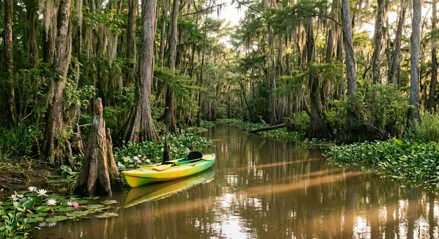
Launch from McGee's Landing on the basin levee and paddle the Big Cypress Loop, a 3.6-mile route through moss-draped cypress forest. It is an easy first day that gets your gear dialed in and introduces the swamp before the longer paddles. Watch for egrets, herons, and roseate spoonbills, and give any alligators a wide berth.
- Drive to Henderson, Louisiana~30 min from Lafayette (LFT) · ~1 hr from Baton Rouge (BTR)
- 3.6 mi · cypress forest paddle · canoe rentals on site
- Swamp birding & wildlifeEgrets, herons, roseate spoonbills · alligators year-round
- Stock up on groceries, water, and fuel in Lafayette before you reach Henderson, which has only limited services.
- McGee's Landing is the one spot in the Henderson swamp that rents canoes and offers unguided paddling, so it is the easiest Big Cypress Loop put-in.
- Pack everything in dry bags and clip your gear in. The black water hides depth, and a swamped kayak in the basin is no fun.
McGee's LandingSwamp birdlifeLake Fausse Pointe State Park Canoe Trail · 6–8 miles
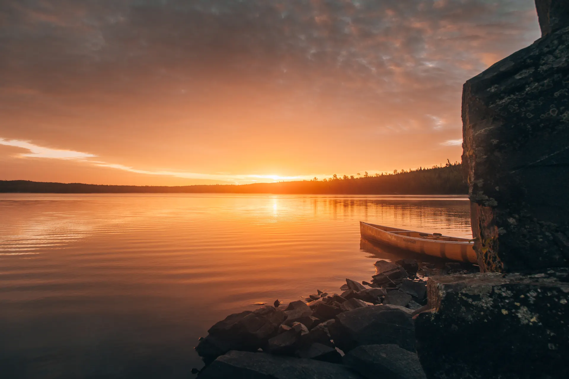
Spanish mossOvernight in the parkDrive about 40 minutes south to Lake Fausse Pointe State Park, a 6,000-acre park bound on the east by the basin levee and on the west by the natural levee of Bayou Teche. It protects one of the most isolated stretches of Louisiana swamp, with a labyrinth of waterways and some enormous old bald cypress.
Paddle the park's marked canoe trail, well signed with color-coordinated markers, so you can go deeper without the navigation risk of the open basin. Kayaks rent for about $7 per hour or $35 per day at the park. Overnight in a waterfront cabin or at a campsite so you are on the water at first light.
- ~40 min south of Henderson · I-10 Exit 115
- Marked canoe trail (Green trail)6–8 mi · color-coded markers · beginner-friendly navigation
- Old-growth bald cypress swamp6,000 acres between the basin levee and Bayou Teche
- Cabins, RV & tent sites · restrooms and showers
- Reserve a Lake Fausse Pointe cabin or campsite 3 to 6 months ahead through lastateparks.com, especially for cooler-season weekends.
- The park's canoe trails are marked with color-coordinated signs, so this is the safest day to explore the maze without a GPS emergency.
- A park entrance fee applies, and the on-site rentals (about $7/hour or $35/day) include two paddles and life jackets if you did not bring your own boat.
Butte La Rose Basin Paddle & Departure · 4–6 miles
On your last morning, drive to the Butte La Rose boat landing and paddle a 4 to 6 mile loop into the main Atchafalaya, exploring bayous and side channels you have not seen yet. This is more open, wilder water than the park, so carry a GPS with pre-loaded maps and check the Butte La Rose gage for current levels before you launch.
Take out, load the boats, and head home through Breaux Bridge, the self-proclaimed Crawfish Capital of the World, for a Cajun lunch to cap the weekend. From there it is a short drive back to Lafayette or Baton Rouge and their airports.
- 4–6 mi · open basin & side bayous · moderate navigation
- Carry a GPS + check water levelsUSGS Butte La Rose gage · cell service is unreliable
- Lunch & depart via Breaux BridgeCrawfish Capital of the World · ~25 min to Lafayette
- The main basin is a maze of look-alike channels, so pre-load your route on Gaia GPS or a Garmin InReach and do not rely on your phone.
- Check the USGS Butte La Rose gage the morning of your paddle. Water levels swing with rainfall and river management and change the currents.
- Leave time for Breaux Bridge on the way out. It is an easy add-on for authentic Cajun food and the natural end point of the loop.
Breaux BridgeLast light in the basinNow build your Atchafalaya trip.
You've seen all three days. Open the free drag-and-drop planner and tune it for your dates, your pace, and whether you camp in the basin or base out of Henderson and Breaux Bridge.
Essential swamp-paddling rules & planning.
Navigate with a GPS
The basin is a complex maze of waterways with little consistent signage. Carry a waterproof map, a compass, and a GPS device with pre-loaded routes (Gaia GPS or a Garmin InReach). Cell service is unreliable, so do not depend on your phone for navigation.
Alligators & wildlife
The Atchafalaya Basin has a large alligator population. Maintain a respectful distance, never feed them, and avoid paddling close to nests or young. Attacks on kayakers are rare but possible if provoked. Keep a whistle, first-aid kit, and headlamp on you.
Camping & Leave No Trace
Designated campsites at Lake Fausse Pointe State Park require reservations and fees. Primitive camping on public lands is generally allowed unless posted, but pack out everything you pack in and bury human waste at least 200 ft from water. Watch for changing water levels overnight.
Check water levels
Water levels in the basin fluctuate significantly with rainfall and river management. Consult the USGS Butte La Rose gage or a local outfitter before your trip, and be aware of currents on the more open stretches near the main channel.
Go October through April
The optimal window is October through April, when temperatures are cooler (roughly 50–70°F) and mosquitoes and gnats are far less active than in the hot, humid summer. Spring brings wildflowers; avoid June through August, when it is hot, buggy, and draining on the water.
Getting there needs a car
Henderson is about 30 minutes from Lafayette Regional Airport (LFT) and an hour from Baton Rouge Metropolitan (BTR). From I-10, take Exit 115 at Henderson. There is no public transit to the launches, so you need a car (and a way to carry or rent boats).
Everything you'll actually want to know.
Ready to go? Get your
Atchafalaya Basin route.
Launches and mileages, the Lake Fausse Pointe canoe trail and cabin bookings, the Big Cypress Loop put-in at McGee's Landing, water-level and GPS notes, and drive times from Lafayette and Baton Rouge to paddle the largest river swamp in the country over a weekend.
Instant book · Free cancellation · Secure payment via Stripe

Planning this trip?
Save it, share it with your crew, or find travelers heading the same way.

Liked this itinerary?
What other travelers are saying
Be the first to leave a tip or question for the next traveler.