George Washington National Forest Hiking:
A 3-Day Virginia Itinerary
Three days of George Washington National Forest hiking in western Virginia: the Big Schloss outcrop, Crabtree Falls, drive-up Reddish Knob, Ramsey's Draft old-growth, and Saint Mary's Falls.
Free interactive planner · drag & reorder your days, add stops, map it in minutes
Build your own George Washington Forest trip, drag, reorder & map it.
Drag stops between days, swap trails, and add your own overlooks and waterfalls with the place search. The live map and drive times recalculate as you go, and we'll warn you before you build a day that has you on remote ridge roads after dark.
Opens a side panel · reorder days, add custom stops, see your route live
One forest, rocky outcrops, waterfalls & old-growth, across western Virginia.
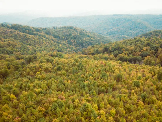
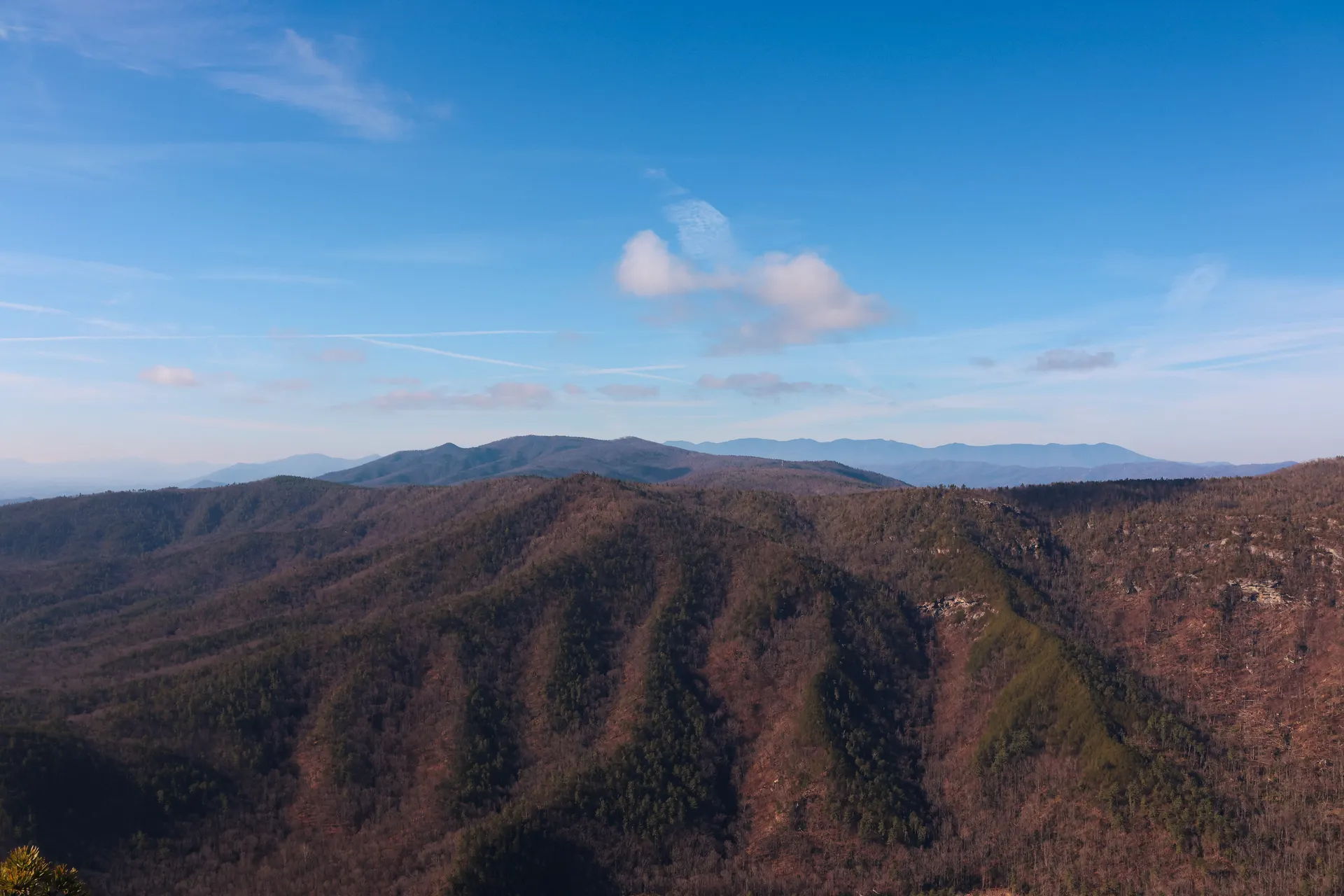
The George Washington National Forest is part of the George Washington & Jefferson National Forests, a vast spread of Appalachian ridge-and-valley country running down the spine of western Virginia and dipping into West Virginia. It wraps around Shenandoah National Park with over a million acres of public land: long forested ridges, rocky outcrops, cold trout streams, and some of the best old-growth left in the East. There is no entrance gate and almost no crowds away from the headline falls.
This 3-day route is built around George Washington National Forest hiking: the iconic Big Schloss outcrop on the Mill Mountain Trail, the tall cascade of Crabtree Falls, the drive-up summit of Reddish Knob on the Virginia/West Virginia line, the old-growth of Ramsey's Draft Wilderness, and Saint Mary's Falls in the Saint Mary's Wilderness. You'll string together the best George Washington National Forest trails with big ridge views and quiet wilderness streams.
Spring brings wildflowers and full streams; fall lights the ridges with color and is the signature season here. This is remote country with black bears, limited cell service, and many gravel forest roads, so carry a paper map, tell someone your plan, and store food properly at camp. Dispersed camping is free across much of the forest, and primitive campgrounds are cheap.
There is no lodging inside the forest, so base in Harrisonburg, Staunton, or Lexington and drive in. Fall weekends fill up fast across the Shenandoah Valley, so book a room early for leaf season. Many forest roads are gravel and remote with little to no cell service, so download offline maps, fill your tank in town, and bring a paper map.


The northern forest · Big Schloss on the Mill Mountain Trail
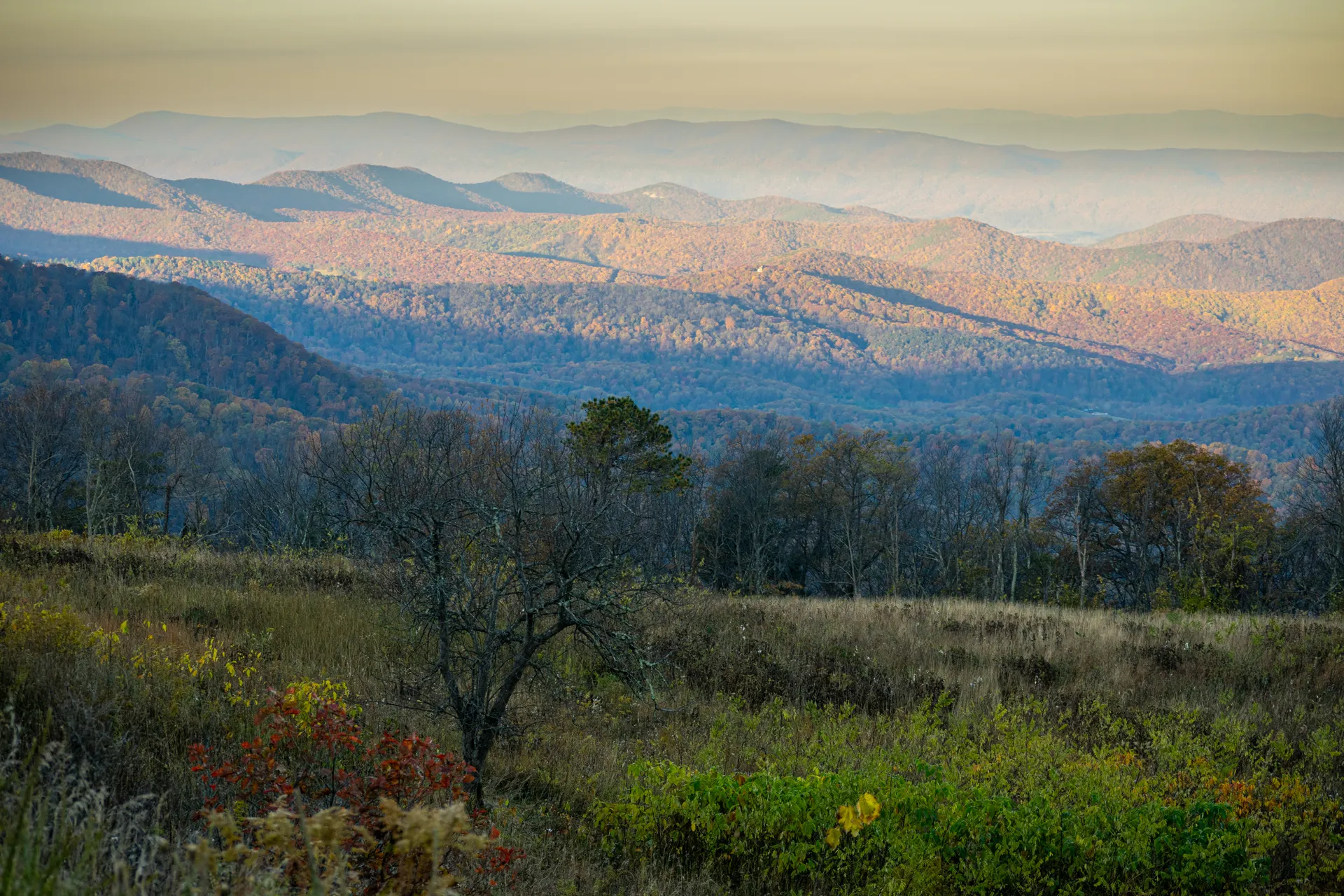
Start in the rugged northern reaches of the forest near Wolf Gap, on the Virginia/West Virginia line. From the Wolf Gap area, climb the Mill Mountain Trail to Big Schloss (about 4 miles round trip), the iconic rocky outcrop of the George Washington National Forest. A short wooden footbridge leads out onto the crag, where the ridges of two states fall away in every direction. This is the signature view of the northern forest.
Big Schloss is the highlight, but the surrounding Trout Run Valley and Tuscarora ridges hold miles of quieter trail if you want to extend. Plan on roughly 1.5 to 2 hours from Harrisonburg or Staunton to the Wolf Gap trailhead on gravel forest roads, so fill up in town and download your maps before you lose signal. Set up at the cheap, primitive Wolf Gap Campground or drive back to a valley town for the night.
- ~4 mi RT · moderate · footbridge onto a rocky crag · the iconic view
- Drive in via Wolf GapGravel forest roads · ~1.5 to 2 hrs from the valley towns · fill up first
- Trout Run Valley ridgesQuiet Tuscarora-area trails to extend the day if you want more
- Camp at Wolf Gap or stay in townPrimitive Wolf Gap Campground · or drive back to Harrisonburg / Staunton
- The footbridge out to the Big Schloss outcrop is exposed, so watch your footing and keep an eye on kids and dogs on the rocks.
- The drive to Wolf Gap is on gravel forest roads with little cell service. Download offline maps and fill your tank in town first.
- Wolf Gap Campground is primitive and first-come, first-served. Bring water or a filter, and store food properly because this is black bear country.

Shenandoah Mountain · Reddish Knob & Ramsey's Draft old-growth

Today is centered on the high spine of Shenandoah Mountain west of Harrisonburg. Drive up to Reddish Knob, one of the highest points in the area at about 4,397 feet, a rare drive-up summit on the Virginia/West Virginia line with a sweeping 360-degree view over endless ridges. Go for sunrise or sunset if you can: the light over the Alleghenies from the bald summit is the best big-sky view in the forest.
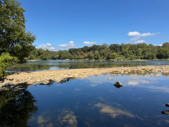
Then hike into Ramsey's Draft Wilderness, home to some of the finest old-growth forest left in the East. The Ramsey's Draft Trail follows the stream up through towering hemlocks and hardwoods (turn it into an out-and-back of any length, with numerous stream crossings). Sections of the Shenandoah Mountain Trail ride the long ridge nearby if you want more. Camp in the wilderness, at a primitive forest site, or return to Staunton or Harrisonburg.
- ~4,397 ft · paved drive-up summit · 360° ridge views · sunrise or sunset
- Out-and-back of any length · towering hemlocks · many stream crossings
- Long ridge trail to extend the day along the high spine
- Camp in the forest or stay in townWilderness or primitive sites · or back to Staunton / Harrisonburg
- Reddish Knob is one of the few summits here you can drive to the top of. Time it for sunrise or sunset for the best light over the Alleghenies.
- The Ramsey's Draft Trail crosses the stream many times and has no bridges. After heavy rain the crossings can be high, so check conditions and turn back if it is unsafe.
- Ramsey's Draft is designated wilderness, so trails are unblazed and rugged. Carry a paper map and compass, and do not count on cell service.
The southern forest · Crabtree Falls, Saint Mary's & Elliott Knob
Head to the southern end of the forest near the Blue Ridge for the waterfalls. Crabtree Falls (about 3 miles round trip to the top) is the tallest cascading waterfall in the eastern United States, dropping roughly 1,200 feet over a series of steps with overlooks all the way up. It is the most popular hike on this route, so start early. Nearby, Saint Mary's Falls in the Saint Mary's Wilderness is a rewarding stream hike to a waterfall and swimming hole.
If you have energy left, Elliott Knob, one of the highest points in the forest at about 4,463 feet, makes a steep climb to a lookout with broad views, and the Appalachian Trail rides the ridge along the eastern edge near the Three Ridges area by the Blue Ridge Parkway. Getting home: Shenandoah (SHD) is closest, with Roanoke (ROA) and Washington Dulles (IAD) the larger airports, each a scenic drive back out through the valley.
- ~3 mi RT · the tallest cascade in the East · overlooks all the way up · start early
- Stream hike to a waterfall and swimming hole · rugged wilderness trail
- ~4,463 ft · steep climb to a lookout · one of the highest points in the forest
- Getting home: SHD, ROA or IADShenandoah closest · Roanoke and Dulles the larger airports
- Crabtree Falls is beautiful but the wet rocks are deadly. People have died climbing off-trail, so stay on the marked path and overlooks the whole way up.
- Saint Mary's Wilderness trails are unblazed and the signed trailhead access road can wash out, so check conditions and carry a map before you go in.
- It is a long, scenic drive back to the airports. Shenandoah (SHD) is closest, with Roanoke (ROA) and Washington Dulles (IAD) the bigger options, so leave with daylight to spare.

Now build your George Washington Forest trip.
You've seen all three days. Open the free drag-and-drop planner and tune it for your dates, your pace, and whether you base in Harrisonburg, Staunton, or Lexington.
What we actually learned on the ridges.
No entrance fee, but a few day-use sites charge
There is no gate or entrance fee for the George Washington National Forest. A handful of developed recreation areas and some trailheads charge a small day-use parking fee, so carry a few dollars or a recreation pass. Dispersed backcountry use is free.
Camping is cheap or free
Dispersed camping is free across much of the forest, and primitive campgrounds like Wolf Gap and Todd Lake are inexpensive. There is no lodging inside the forest, so for a roof base in Harrisonburg, Staunton, or Lexington and drive in each day.
Forest roads are gravel and remote
Many trailheads sit at the end of long gravel forest roads with little to no cell service. Some roads are rough, seasonal, or gated in winter. Download offline maps, screenshot your directions, and carry a paper Forest Service map.
Spring and fall are the prime seasons
Spring brings wildflowers and full streams; fall is the signature season, with the ridges lighting up in color in October. Summer is humid and buggy at lower elevations, and winter can close high gravel roads, so plan around the shoulder seasons.
This is black bear country
Black bears live throughout the forest. Store food in a bear canister or hang it well away from camp, never leave food in your tent, and keep a clean campsite. Give any bear plenty of space and never approach one for a photo.
Treat your water and respect the falls
Streams here run clear but should be filtered or treated before drinking. At Crabtree Falls and other cascades, stay on the marked trail and overlooks: the wet rock is lethally slick and has killed careless hikers who climbed off-trail.
Everything you'll actually want to know.
Ready to go? Get your
George Washington Forest hiking route.
Trailheads and mileages, the drive-up summits, the best waterfalls, gravel-road and cell-service warnings, valley basecamps, and the spring and fall timing you need to hike the George Washington National Forest.
Instant book · Free cancellation · Secure payment via Stripe

Planning this trip?
Save it, share it with your crew, or find travelers heading the same way.

Liked this itinerary?
What other travelers are saying
Be the first to leave a tip or question for the next traveler.