
Two Days in Congaree:
Boardwalks & Old-Growth Swamp
Two days exploring what to do in Congaree National Park: the elevated Boardwalk Loop, the Weston Lake Loop, a Cedar Creek paddle through the old-growth swamp, and the famous fireflies.
Free interactive planner · drag & reorder your days, add stops, map it in minutes
Build your own Congaree trip, drag, reorder & map it.
Drag stops between days, swap a trail, and add your own overlooks and put-ins with the place search. The live map and drive times recalculate as you go, and we'll flag if you stack too much into one humid afternoon in the swamp.
Opens a side panel · reorder days, add custom stops, see your route live
One park, old-growth giants & a black-water swamp, near Columbia.
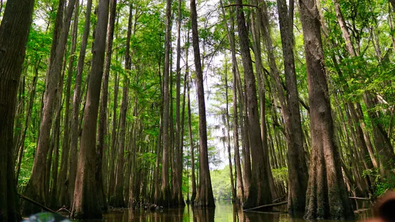
Congaree National Park protects the largest intact tract of old-growth bottomland hardwood forest left in the United States, a flood-fed wilderness of towering bald cypress, loblolly pine, and water tupelo on the floodplain of the Congaree and Wateree rivers. Some of the tallest trees in the eastern US grow here, and the whole forest is laced with creeks, sloughs, and cypress knees rising out of the tea-colored water.
This 2-day route covers what to do in Congaree National Park without rushing it: the elevated Boardwalk Loop Trail from the Harry Hampton Visitor Center, the longer Weston Lake Loop, and a paddle down the marked Cedar Creek canoe trail through the heart of the old-growth swamp. Congaree is small and free to enter, so it pairs perfectly with a base in Columbia about 30 minutes away.
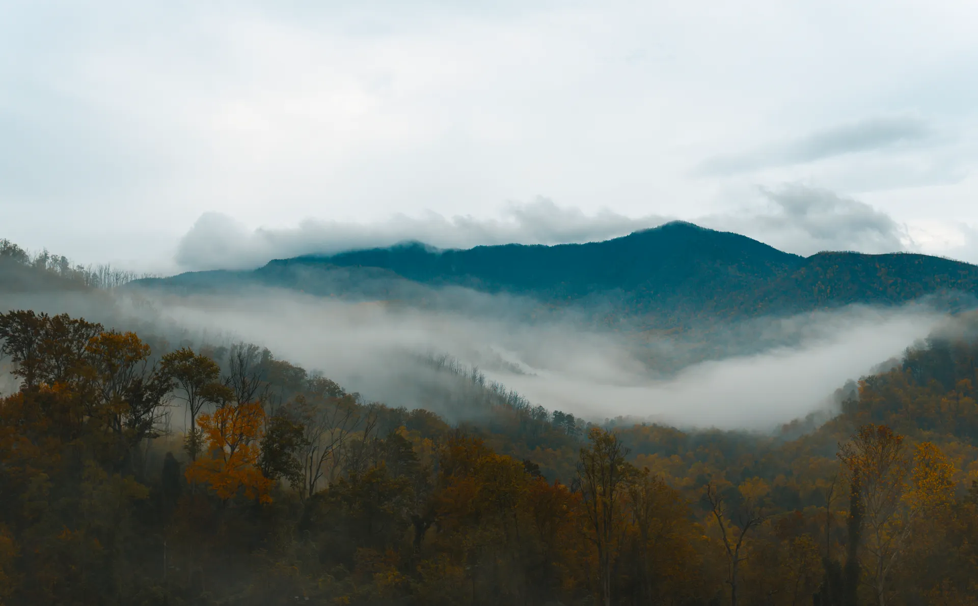
Fall through spring brings cooler, less buggy days and the chance of higher water for paddling. Summer is hot, humid, and famously full of mosquitoes (the visitor center even has a "mosquito meter"), so bring repellent. The park sits on a floodplain, so after heavy rain the boardwalk and trails can flood and close; always check current conditions with the park before you go.
There is no lodging inside Congaree, only the Longleaf and Bluff walk-in campgrounds, so most visitors base in Columbia about 30 minutes away. If you want a ranger-led canoe tour on Cedar Creek, reserve well ahead through the park, since these free guided trips fill fast. The synchronous fireflies event (typically mid-May to early June) uses a vehicle lottery on recreation.gov, so plan that months out.


The Boardwalk Loop & Weston Lake from the visitor center
Start at the Harry Hampton Visitor Center, where the rangers post current flood and trail conditions and the famous "mosquito meter" rates the bug situation from "all clear" to "war zone." Grab a trail map, check whether the boardwalk is open (it can flood after heavy rain), and load up on repellent before you head out.
From the visitor center, walk the Boardwalk Loop Trail (about 2.4 miles, the park's signature elevated walk), which carries you on a raised wooden path through cathedral-like old-growth bald cypress, loblolly pine, and tupelo without ever touching the mud. To go deeper, link onto the Weston Lake Loop Trail (about 4.4 miles total) out to a quiet oxbow lake where you can often spot turtles, wading birds, and the occasional otter.
- ~2.4 mi · easy · elevated boardwalk · the signature walk
- ~4.4 mi · easy · oxbow lake · wildlife viewing
- Trail maps · flood conditions · the "mosquito meter"
- Base in Columbia or camp in the parkNo in-park lodging · Longleaf & Bluff campgrounds only
- Start at the Harry Hampton Visitor Center to check whether the boardwalk is open. The park sits on a floodplain, and the lower boardwalk can flood and close after heavy rain.
- Bring insect repellent. The visitor center posts a "mosquito meter," and from late spring through summer the bugs can be intense, especially deeper on the loop trails.
- The Boardwalk Loop is flat and partly accessible, but the Weston Lake Loop leaves the boardwalk for natural-surface trail that can be muddy. Wear shoes you do not mind getting dirty.

Paddle Cedar Creek & a longer loop into the wilderness


Day two gets you onto the water. The marked Cedar Creek canoe trail is the best way to feel Congaree's old-growth swamp, drifting on tea-colored black water between buttressed cypress trunks and knees, with prothonotary warblers, herons, and turtles all around. Bring or rent your own canoe or kayak, or reserve a free ranger-led canoe tour through the park, which fills up fast.
If you would rather stay on foot, lace up for a longer loop into the backcountry: the Oakridge Trail (about 6.6 miles) winds through deep old-growth, the Kingsnake Trail is a quieter route prized for birding, and the River Trail runs roughly 10 miles down to the Congaree River itself. Getting home: Columbia and its airport (CAE) are about 30 minutes away, so you can paddle or hike in the cooler morning and still make an afternoon flight.
- Marked paddle through the old-growth swamp · bring/rent your own or join a ranger tour
- ~6.6 mi · easy to moderate · deep old-growth backcountry
- Quieter trail · prized for birding · access can flood
- Getting home: Columbia (CAE)Columbia Metropolitan Airport ~30 min · easy afternoon flight
- There are no boat rentals inside the park. Bring your own canoe or kayak, rent from an outfitter in the Columbia area, or reserve a free ranger-led canoe tour through the park well in advance.
- Cedar Creek water levels swing with rainfall. Too low and the creek is hard to paddle; too high and there can be strong current and deadfall, so check the park's paddling conditions before you launch.
- For the longer trails like Oakridge, Kingsnake, and the River Trail, carry a map and watch for trail markers. Sections can flood, and the flat, similar-looking forest makes it easy to lose your bearings.
Now build your Congaree trip.
You've seen both days. Open the free drag-and-drop planner and tune it for your dates, your pace, and whether you base in Columbia or camp inside the park.
What we actually learned in the swamp.
The park is free to enter
Congaree National Park charges no entrance fee, so you can come and go without a pass. The walk-in Longleaf and Bluff campgrounds do require a small reservation fee through recreation.gov, but day use and the boardwalk are completely free.
Bring serious insect repellent
This is a swamp, and the mosquitoes can be fierce from late spring into fall. The Harry Hampton Visitor Center posts a "mosquito meter" rating the day's bugs. Bring repellent, wear long sleeves on the loop trails, and the boardwalk is usually a bit breezier and clearer.
Check flood and trail conditions first
Congaree sits on a river floodplain, so after heavy rain the lower boardwalk and many trails can flood and close. Always check the park's current conditions page or call the visitor center before you drive out, and have a backup plan in high water.
Go fall through spring
October through April brings cooler temperatures, fewer bugs, and often better water for paddling. Summer is hot, humid, and buggy. Mid-May into early June is firefly season, which is special but draws a managed crowd via a lottery.
No lodging in the park, so base in Columbia
There are no hotels or cabins inside Congaree, only the Longleaf and Bluff walk-in campgrounds. Most visitors stay in Columbia about 30 minutes away, which has plenty of lodging, restaurants, and the nearest airport (CAE).
Reserve ranger-led canoe tours early
Paddling Cedar Creek is the highlight for many visitors. There are no rentals in the park, so bring your own boat, rent in Columbia, or grab one of the free ranger-led canoe tours, which are reservation-only through the park and fill up quickly.
Everything you'll actually want to know.
Ready to go? Get your
Congaree 2-day route.
Trailheads and mileages, the Cedar Creek paddle, the visitor center and mosquito meter, where to base in Columbia, and the flood and firefly-season timing you need to plan Congaree right.
Instant book · Free cancellation · Secure payment via Stripe

Planning this trip?
Save it, share it with your crew, or find travelers heading the same way.

Liked this itinerary?
What other travelers are saying
Be the first to leave a tip or question for the next traveler.