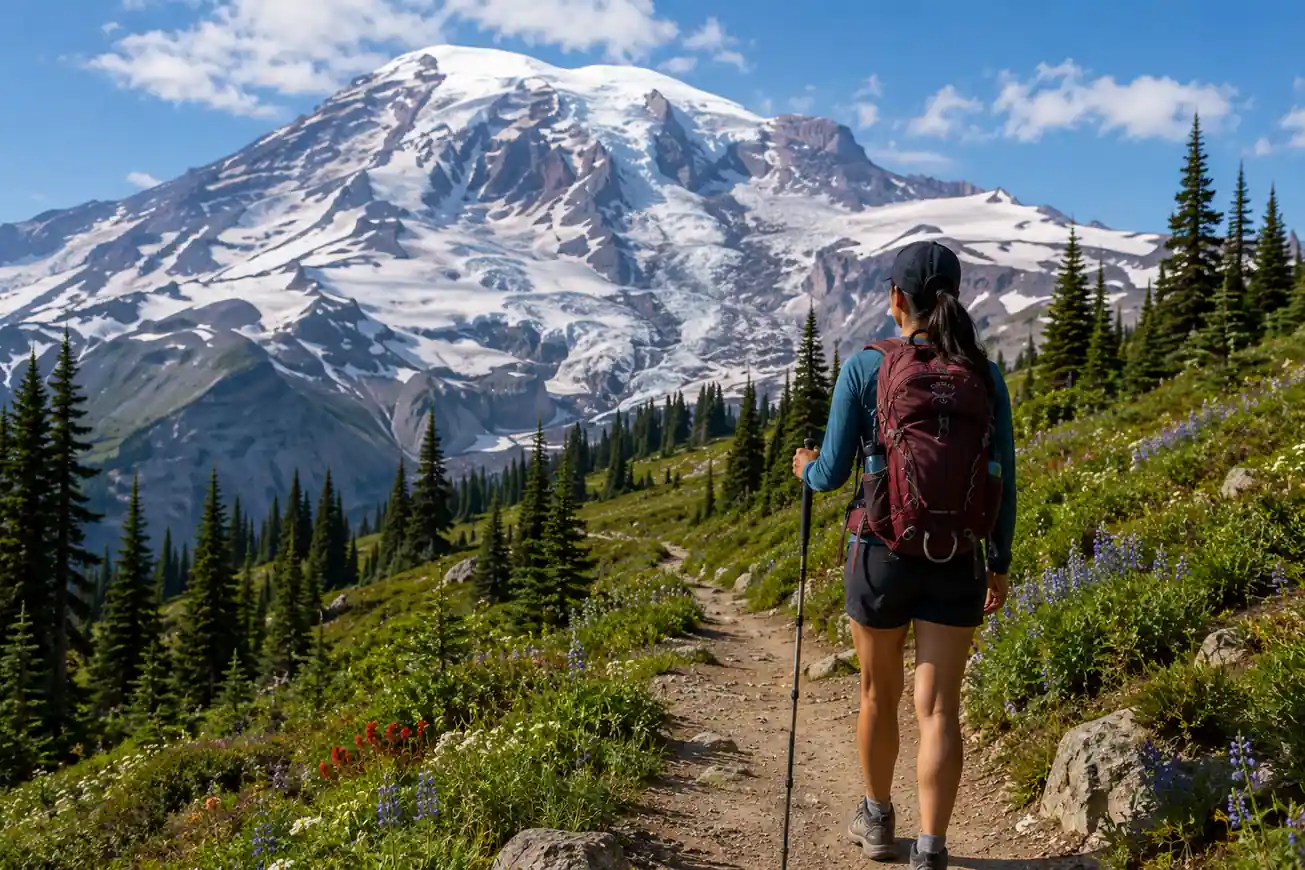
Mt. Rainier is the most glaciated peak in the contiguous United States — 25 named glaciers covering 35 square miles. On clear days it's visible from 100 miles away, dominating the Washington skyline. The hiking is built around two main areas: Paradise on the south side (wildflowers, glaciers, most visitors) and Sunrise on the northeast (quieter, higher, longer views). Both are spectacular in different ways.
Overview
- Location: Mt. Rainier National Park, Washington State
- Park fee: $35/vehicle, valid 7 days
- Best season: Mid-July through September (Paradise wildflower peak: late July)
- Timed entry: Required for Paradise area July–September. Book on recreation.gov up to 2 weeks ahead. Day-of passes available if unused reservations remain.
- Permits: Required for overnight backcountry camping. Day hiking needs no permit.
- Wilderness conditions: Snow can remain on high trails well into July. Check trail conditions at the Longmire or Paradise Visitor Center before heading out.
Paradise: Best Trails
Paradise (5,400 ft) is the park's most visited area, and rightfully so — in July and August the wildflower meadows are among the most spectacular in North America.
Skyline Trail Loop — The Best Day Hike
- Distance: 5.5 miles loop
- Elevation gain: 1,400 ft
- Difficulty: Moderate
- Highlights: Panorama Point (stunning summit view at 6,800 ft), Myrtle Falls, and the full Skyline wildflower meadow loop above treeline.
- Note: The upper section may have snow until late July. Poles and microspikes help early in the season.
Alta Vista Summit
- Distance: 1.7 miles round trip
- Elevation gain: 600 ft
- Difficulty: Easy-moderate
- Short but rewarding — summit views of Rainier above the wildflower meadows. Best quick hike from the Paradise parking lot.
Nisqually Vista
- Distance: 1.2 miles round trip
- Elevation gain: 200 ft
- Difficulty: Easy
- Views of the Nisqually Glacier — one of the few remaining advancing glaciers on Rainier. Excellent photography at dawn when the mountain reflects in the meltwater pools.
Sunrise: High Country Without the Crowds
Sunrise (6,400 ft) is the highest point reachable by car in the park. Fewer visitors than Paradise, more exposed terrain, and direct sightlines to Emmons Glacier — the largest glacier in the lower 48.
Burroughs Mountain Trail
- Distance: 7 miles round trip (First Burroughs) to 12 miles (Second Burroughs)
- Elevation gain: 1,500–2,500 ft depending on destination
- Difficulty: Moderate to strenuous
- The best ridge hike in the park. First Burroughs (7,400 ft) opens views of Emmons Glacier. Second Burroughs (7,828 ft) is fully above treeline — tundra, marmots, and the mountain filling the sky to the west.
Sourdough Ridge Nature Trail
- Distance: 1.5 miles
- Elevation gain: 150 ft
- Short ridge walk from the Sunrise Visitor Center with unobstructed views of Rainier and the Emmons Glacier. Best easy hike at Sunrise — do it first, then decide if you want to continue on Burroughs.
The Wonderland Trail
The Wonderland Trail circles the entire mountain — 93 miles, 22,000 ft of elevation gain, typically completed in 10–17 days. This is one of the premier backpacking trails in the US.
- Permit: Highly competitive lottery in March on recreation.gov. Walk-up permits available daily for leftover sites.
- Best section hiking: Carbon River to Mowich Lake (6 miles, rain forest and old-growth alder) or Longmire to Paradise via Indian Henry's Hunting Ground (11 miles).
- Bear canisters: Required throughout the backcountry. Rentable at Longmire.
- Campsites: 18 designated wilderness camps with pit toilets and bear poles or boxes. No campfires.
Carbon Glacier: Old-Growth Rain Forest Access
- Carbon River Road: Washed out and closed to vehicles — accessible by foot or bike. The 5-mile bike/walk to the glacier terminus goes through one of the only inland temperate rain forests in the US.
- This section of Rainier gets only 2–3% of the park's visitors. Completely different ecosystem from Paradise — moss-draped old-growth, ferns, and the lowest glacier snout in the contiguous US.
Permits & Planning
- Day hiking: No permit needed. Timed entry for Paradise required July–September.
- Overnight backpacking: Permit required. Lottery in March; walk-up daily at Longmire or White River Wilderness Information Centers.
- Summit climbing: Climbing registration required for all routes above 10,080 ft. $52/person. Guided climbs available through Rainier Mountaineering Inc.
- Roads open: Paradise Road opens May/June depending on snowpack. Sunrise Road typically opens July 1. Check nps.gov/mora for current conditions.
Gear for Rainier
- Waterproof rain jacket — even in August, afternoon clouds and rain are common.
- Microspikes for early-season high trails (July snowfields).
- Bear canister for overnight trips (required).
- Poles for steep descents from Burroughs or Skyline.
- Layers — temperature drops 3.5°F per 1,000 ft of elevation. Paradise can be 20°F cooler than the Longmire valley.
Where to stay
Inside Park · Open year-round
Nisqually Entrance · Park Gateway
East Side Access · Ohanapecosh

Did this guide help you?
Want our free Google Maps of the best outdoor spots?
A hand-picked Google Maps list of the best hiking, kayaking, and camping spots, scenic viewpoints, and other outdoor activities across the US, sent straight to your inbox.